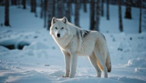
Introduction
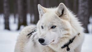
Satellite imagery is a powerful tool in Arctic wolf conservation, offering unparalleled insights into their habitats and movements
This article explores the technologies behind satellite imagery, the benefits of monitoring and tracking Arctic wolves, and how environmental changes are detected. We will also evaluate the advantages and limitations of using satellite data compared to traditional conservation methods
By understanding these aspects, we can better appreciate the role of satellite imagery in protecting Arctic wolves and their fragile ecosystem
Monitoring Arctic Wolf Habitats with Satellite Imagery
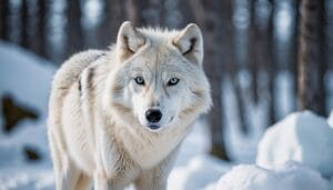
Satellite imagery plays a crucial role in monitoring the habitats of Arctic wolves, providing detailed and comprehensive data that is invaluable for conservation efforts. This section delves into the technologies used in satellite imagery, the benefits of habitat monitoring, and how satellites can detect environmental changes that impact Arctic wolves
Technologies Used in Satellite Imagery
Several advanced technologies are employed in satellite imagery to monitor Arctic wolf habitats. These include multispectral and hyperspectral imaging, which capture data across multiple wavelengths of light, allowing for the detailed analysis of vegetation and terrain
Synthetic Aperture Radar (SAR) is another essential technology, capable of penetrating clouds and providing high-resolution images regardless of weather conditions. Thermal imaging is also used to detect heat signatures, which can help identify animal presence and activity
These technologies enable researchers to gather critical information about the Arctic environment, including the extent of snow and ice cover, vegetation health, and water availability. By combining these data sources, conservationists can create accurate and up-to-date maps of Arctic wolf habitats, essential for effective management and protection efforts
Benefits of Habitat Monitoring
The benefits of using satellite imagery for habitat monitoring are numerous. One significant advantage is the ability to cover vast and remote areas that are otherwise difficult to access
Arctic regions are often challenging to navigate due to extreme weather conditions and rugged terrain, making ground-based surveys time-consuming and costly. Satellite imagery provides a cost-effective and efficient alternative, allowing for regular and comprehensive monitoring
Furthermore, satellite imagery offers high temporal resolution, meaning that images can be captured frequently. This is particularly important for detecting changes in the environment over time, such as seasonal variations in snow cover or vegetation growth
Continuous monitoring helps identify trends and potential threats to Arctic wolf habitats, enabling timely interventions to mitigate adverse effects
Detecting Environmental Changes
Environmental changes, such as those caused by climate change, have profound impacts on Arctic wolf populations. Satellite imagery is instrumental in detecting these changes and assessing their effects on the ecosystem
Impact of Climate Change on Arctic Wolves
Climate change poses significant challenges to Arctic wolves by altering their habitats and prey availability. Rising temperatures lead to the melting of sea ice and changes in snow patterns, affecting the distribution and abundance of prey species like caribou and muskoxen
Satellite data can track these changes in real-time, providing crucial information on how climate change is reshaping the Arctic landscape
Using Satellites to Monitor Environmental Health
In addition to tracking climate change, satellite imagery is used to monitor overall environmental health. This includes assessing vegetation cover, identifying areas of habitat degradation, and detecting pollution events such as oil spills. By providing a comprehensive overview of the Arctic environment, satellite data helps conservationists implement targeted strategies to preserve and restore critical habitats
The integration of satellite imagery into conservation efforts enhances our ability to protect Arctic wolves by offering a detailed and dynamic view of their habitats
This technology not only aids in monitoring current conditions but also in predicting future changes, ensuring that conservation measures are proactive and effective
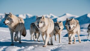
Tracking Arctic Wolf Movements with Satellite Data
Tracking the movements of Arctic wolves is essential for understanding their behavior, population dynamics, and interactions with their environment. Satellite data offers precise and comprehensive tracking capabilities that are invaluable for conservationists
This section explores the techniques used to track Arctic wolf movements, the accuracy of these methods, and highlights case studies demonstrating their effectiveness
Tracking Techniques and Accuracy
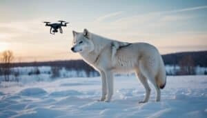
Several sophisticated techniques are used to track Arctic wolf movements via satellite data. One primary method involves the use of GPS collars fitted on wolves. These collars transmit location data to satellites, providing real-time tracking of individual wolves’ movements
The data collected includes coordinates, speed, and travel paths, which can be analyzed to understand their range, hunting patterns, and social behaviors
Another technique is the use of Argos satellite tracking, which involves transmitting data from tags attached to the wolves to satellites. This method is particularly useful for tracking movements over large distances and in remote areas where ground-based tracking is impractical. The Argos system provides accurate location data and can also record environmental parameters such as temperature and salinity, offering additional context for the wolves’ movements
The accuracy of satellite tracking is generally high, with GPS collars providing location data with an accuracy of a few meters. Argos tracking, while slightly less precise, still offers valuable data with an accuracy range of a few hundred meters
These methods ensure that researchers have reliable information on the movements and behaviors of Arctic wolves, which is crucial for effective conservation planning
Case Studies of Wolf Tracking
Several case studies highlight the effectiveness of satellite tracking in Arctic wolf conservation. One notable example is the study conducted in the Canadian Arctic, where researchers used GPS collars to track the movements of a wolf pack over several years
The data revealed extensive travel patterns, with wolves covering vast distances in search of food and suitable habitats. This information helped conservationists understand the wolves’ territorial range and the critical areas that needed protection to ensure their survival
Another case study involved tracking the migration of Arctic wolves on Ellesmere Island. Researchers used Argos satellite tags to monitor the movements of wolves as they followed migrating caribou herds. The study provided insights into the wolves’ reliance on migratory prey and highlighted the importance of preserving both predator and prey habitats to maintain ecological balance
These case studies demonstrate how satellite tracking can provide detailed insights into the lives of Arctic wolves, informing conservation strategies that are based on solid scientific data
Evaluating Satellite Imagery in Conservation Efforts
Satellite imagery is a powerful tool in conservation, offering numerous benefits for monitoring and protecting Arctic wolves. However, it also has its challenges and limitations
This section evaluates the advantages of satellite imagery over traditional methods, as well as the challenges and limitations associated with its use in conservation efforts
Advantages Over Traditional Methods
One of the primary advantages of satellite imagery is its ability to cover large and remote areas. Traditional methods, such as ground surveys and aerial reconnaissance, can be limited by accessibility, weather conditions, and resource constraints
Satellite imagery, on the other hand, can provide comprehensive coverage of vast regions like the Arctic, making it possible to monitor habitats and wildlife populations that are difficult to access
Satellite imagery also offers high temporal resolution, allowing for frequent updates and continuous monitoring. This is particularly important for detecting and responding to changes in the environment, such as seasonal variations, habitat destruction, or climate change impacts
Traditional methods often lack this temporal depth, making it harder to identify and track changes over time
Additionally, satellite imagery provides data in multiple spectral bands, including visible, infrared, and thermal. This multi-spectral approach enables a more detailed analysis of environmental conditions and wildlife behavior
For example, thermal imaging can help detect heat signatures of animals, while infrared imagery can assess vegetation health and cover
Challenges and Limitations
Despite its advantages, satellite imagery also presents several challenges and limitations. One significant challenge is the initial cost of acquiring and processing satellite data. High-resolution imagery and advanced analytical tools can be expensive, potentially limiting their availability to conservation projects with substantial funding
Another limitation is the dependency on clear skies and favorable weather conditions for optical satellite imagery. Clouds, snow, and ice can obstruct the view, making it difficult to obtain accurate images
While technologies like Synthetic Aperture Radar (SAR) can penetrate clouds and provide reliable data regardless of weather, they are not always available or used in all conservation projects
The interpretation of satellite data also requires specialized skills and expertise. Analyzing and interpreting multi-spectral data to derive meaningful insights about wildlife habitats and behavior can be complex and requires trained personnel. This can be a barrier for conservation organizations that lack the necessary technical expertise
Furthermore, while satellite imagery provides excellent spatial and temporal coverage, it may lack the fine-scale detail that ground-based methods can offer. For instance, subtle behavioral cues or specific habitat features may be more easily observed through direct fieldwork
Despite these challenges, the integration of satellite imagery into conservation efforts has proven to be a valuable asset. It complements traditional methods by providing a broader perspective and enabling more effective monitoring and management of Arctic wolf populations and their habitats
Conclusion
Satellite imagery has revolutionized Arctic wolf conservation by providing comprehensive and precise data on their habitats and movements. Advanced technologies such as multispectral imaging, Synthetic Aperture Radar, and thermal imaging enable detailed monitoring of remote and expansive Arctic regions
This allows for effective habitat mapping, detection of environmental changes, and real-time tracking of wolf populations. The advantages of satellite imagery, including vast coverage and high temporal resolution, enhance conservation efforts by offering insights that traditional methods cannot
However, challenges such as high costs, weather dependencies, and the need for specialized expertise must be addressed. Overall, the integration of satellite data with conventional approaches offers a powerful strategy for ensuring the survival and well-being of Arctic wolves in their changing environment